The Lena Trough experiment 2008
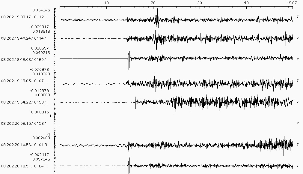
During Polarstern cruise ARK XXIII/2 from 04/07/08 to 10/08/08, three seismometer arrays each including three stations with three-component broadband sensors were deployed on seaice above the southernmost part of Lena Trough (80.5 N, 1.5 W), where the transition to the Spitsbergen Fracture Zone occurs. Lena Trough is the southern end of the Arctic mid-ocean ridge system and spreads passively with ultra-slow spreading rates between East Greenland and Spitsbergen/Yermak Plateau. Seismicity has been documented from the trough but has never been measured insitu before, because prevailing seaice prevents a simple installation of ocean bottom seismometers. Thus, the seismic stations were installed on top of pressure ice ridges where the ice is thick enough to support helicopter landings and were equipped with ARGOS transmitters to keep track of the stations while the seaice was drifting. After around 10 days of runtime the stations were recovered when flight conditions allowed it. During this time the ice had drifted nearly 100 km predominantly to the south and meltwater lakes on the ice extended dramatically. Data was registered on the vertical channel during 80 to 90% of the recording time, whereas horizontal channels failed during most of this period. The recorded data consists of events occurring within the ice sheet, but also more than 30 regional earthquakes could be registered.
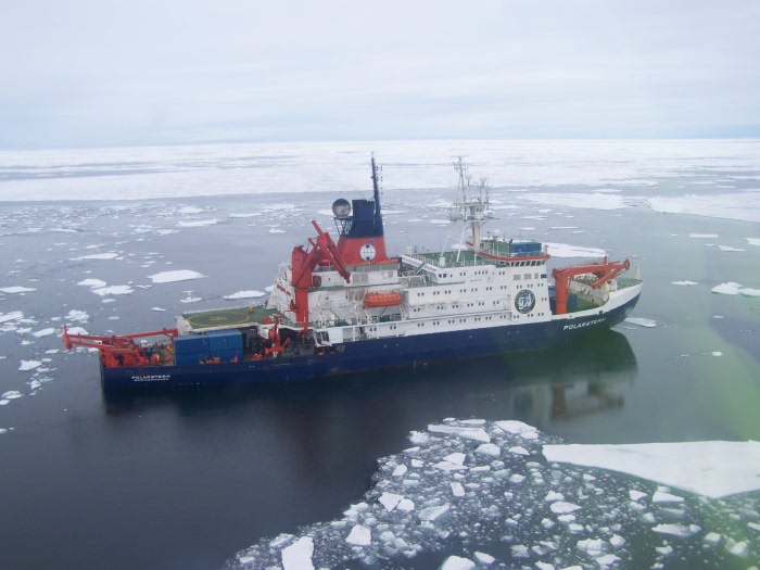
Figure 4:The R/V Polarstern during curise ARK XXIII/2.
Publications
ReportsC. Riedel, C. Läderach, E. Korger (2008) SEISMOLOGY: RECORDING THE SEISMICITY OF LENA TROUGH WITH SEISMOMETERS ON DRIFTING ICE FLOES in Cruise Report, Polarstern ARK XXIII/2
Communications
C. Laederach, C. Riedel, E. Korger, V. Schlindwein (2009) Preliminary results from the seismic array setup above Lena Trough during Polarstern cruise ARK XXIII/2, Poster at DGG conference 2009, Kiel, Germany
W. Metzner, D. Meckel (2008) E-Mail von der Scholle, Stern-Online, Arktis-Expedition (3)
Picture gallery
Polarstern ARK XXIII/2@Picasa